E+
4:00 h
10km
550
9
THE HIKE
Just above Montreaux, on Lake Geneva, stands the Rochers de Naye , a 2000 meter pillar of rock. But on its top, it puts on display a completely different landscape: an idillic green plateau, bordered by a circle of blunt peaks, which then fall vertically onto the surrounding plain.
Already interesting morphologically, the Rochers de Naye also boasts one of the best views of Lake Geneva / Lac Lemanne, and a rack railway that almost reaches its top.
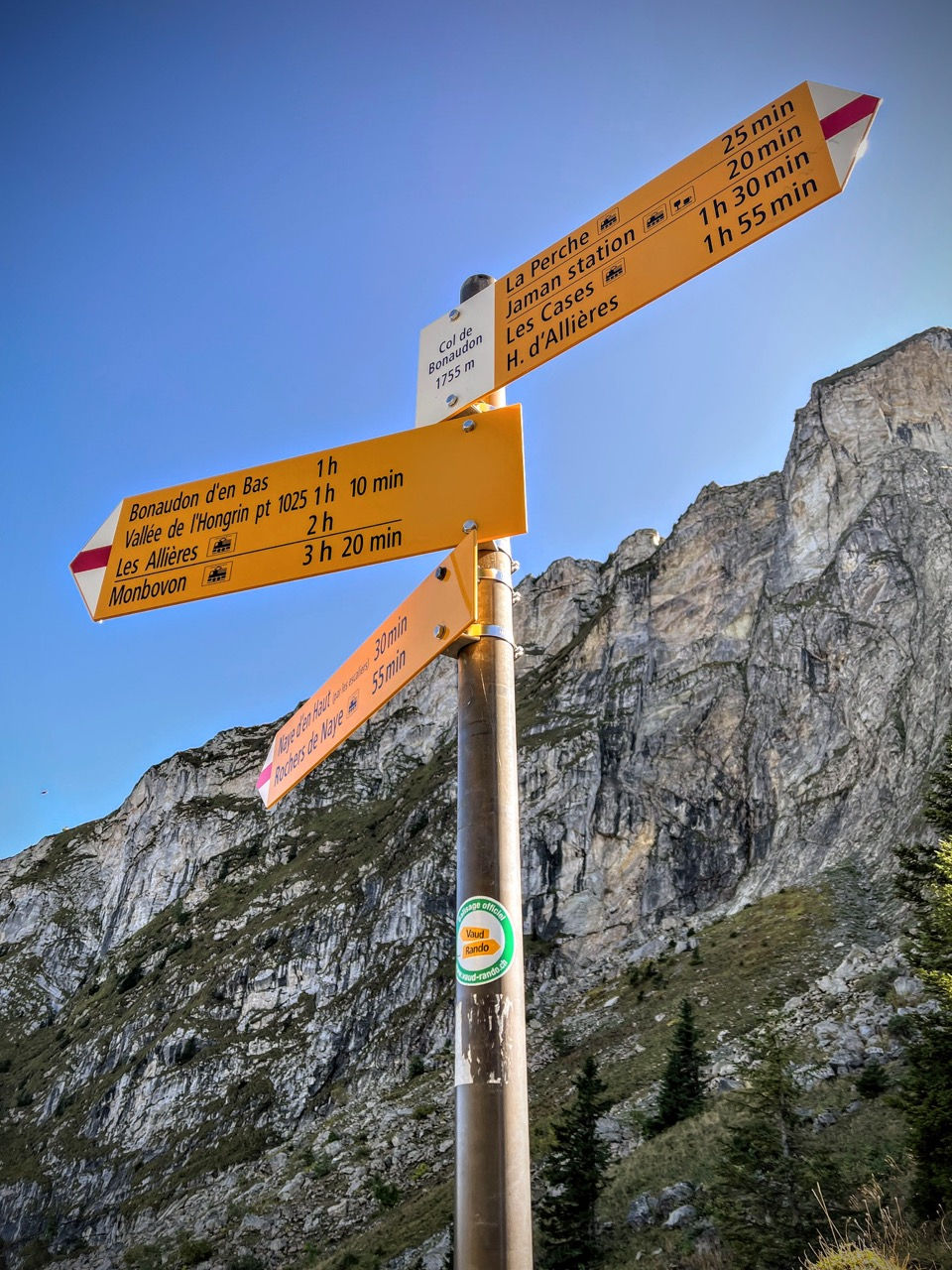
We start from the Col de Jaman (1512m) because the ascent route from there is as spectacular as the views from the summit - however, you can shorten the excursion by taking the train for part of the route, for example from Caux to the summit, or from Jaman mountain station.
It is better to dedicate a day with clear skies to this excursion, when the views extend over Lake Geneva, and over the mountains up to the Gran Combin and the Eiger.
We recommend following the ring in an anti-clockwise direction, to face a section of chains and ladders going uphill instead of downhill.
Ascent: to the Grottes de Naye and the Rochers de Naye
We start from Col de Jaman (1512m). A very narrow road with few clearings reaches it. At the hill we find a large free car park, with a refreshment bar (which we found closed) and a hut that sells cheese and cured sausages.
From here we take the dirt road that goes down east of the hill. Then, with hairpin bends and curves, it begins to climb into a beautiful grove, passes a hut with a wooden roof, and takes us to a crossroads where we turn left onto a path that takes us on a slight slope up to a beautiful toothed fork (there is also a trace of a path that goes directly up to the fork).
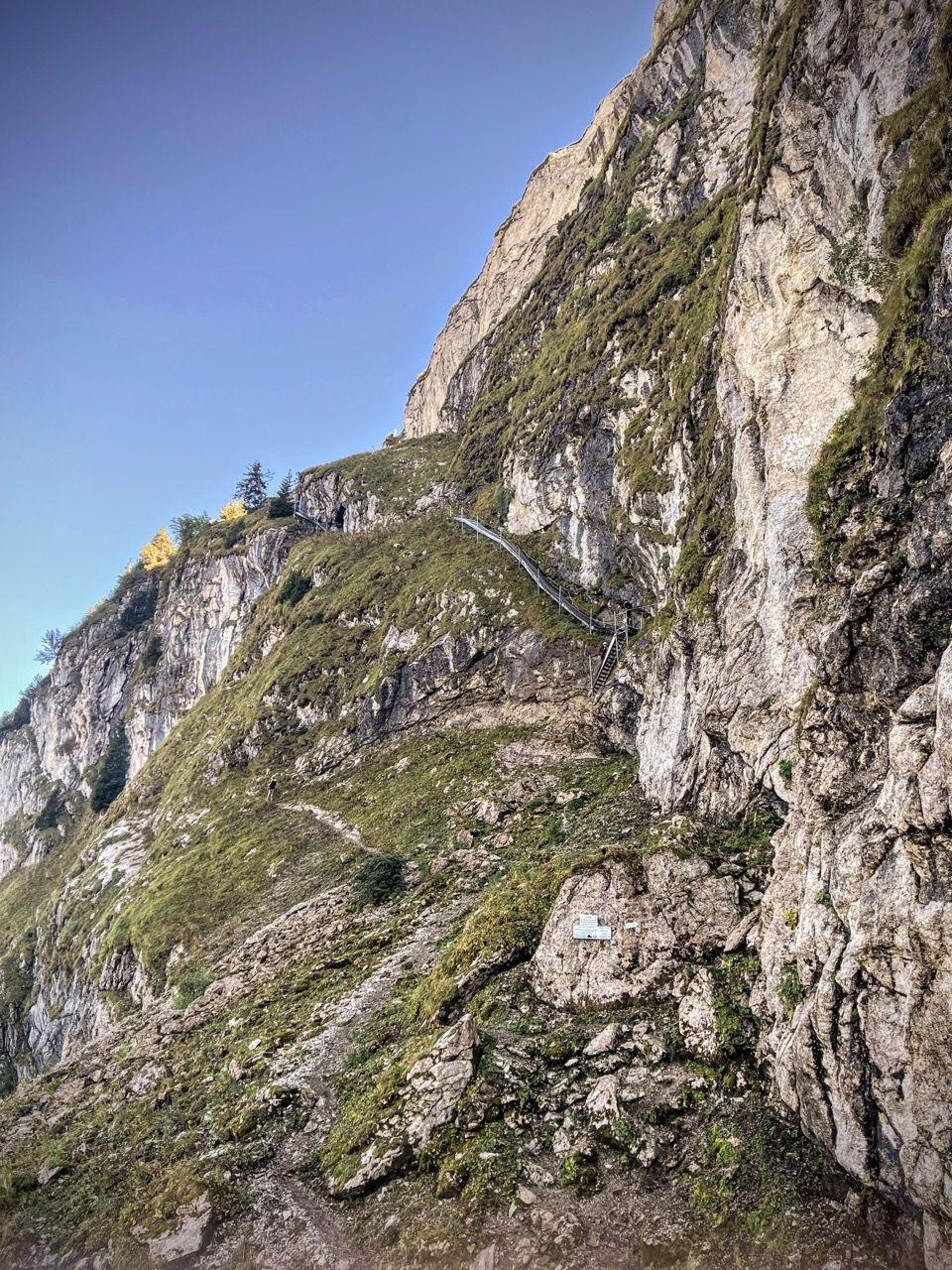
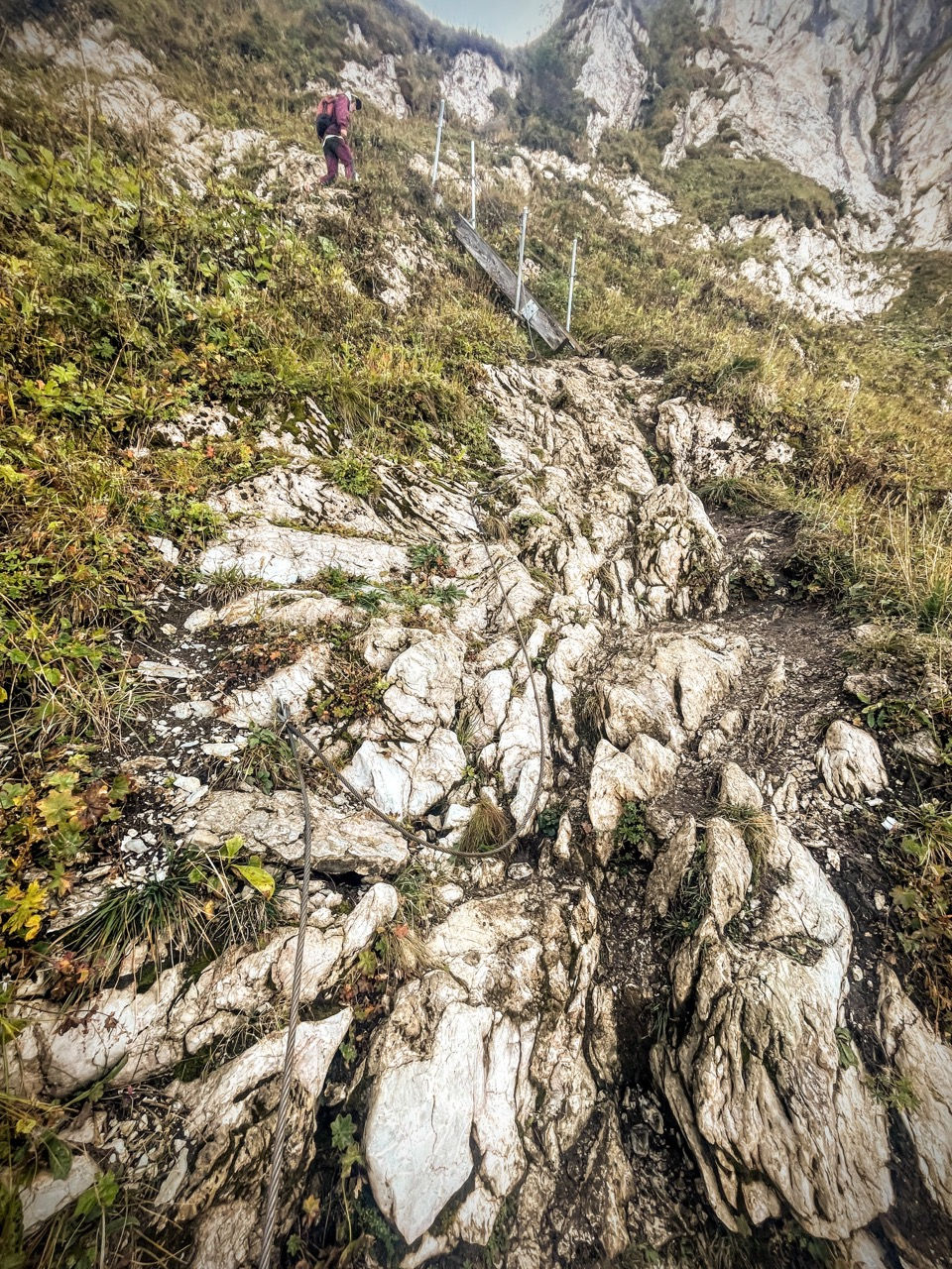
We are at the foot of the vertical cliff of Rochers de Naye, which we will go around first on the left with a nice equipped path, and then on the right with a normal path. There is also a Via Ferrata (difficulty D/E - very difficult) which goes straight up the cliff.
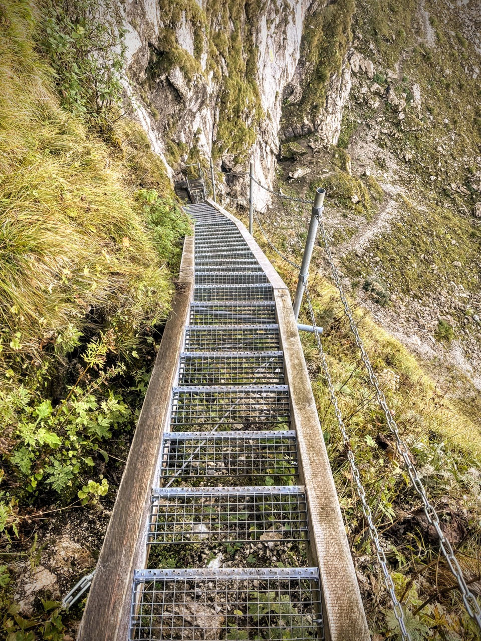
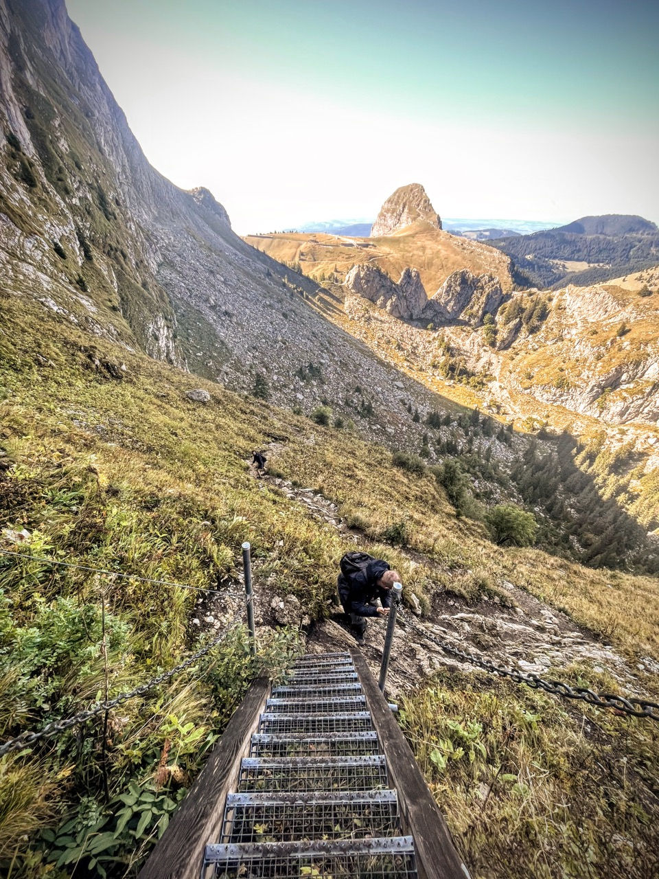
From the fork we can already see the "path of the stairs" that awaits us, characterized by a long iron ladder, and some short sections with chains higher up. This stretch is exposed, but almost entirely equipped with chains. Good shoes and some mountain experience required.
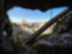
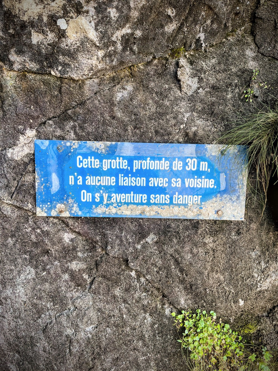
At the base of the staircase we find the first (and narrowest) of 3 entrances to the Grottes de Naye, a system of tunnels about thirty meters long, partially equipped inside.
We take the dizzying ladder and then continue with chains and other short ladders up to the top, conquering the ridge that will lead us to the summit of Rochers de Naye.
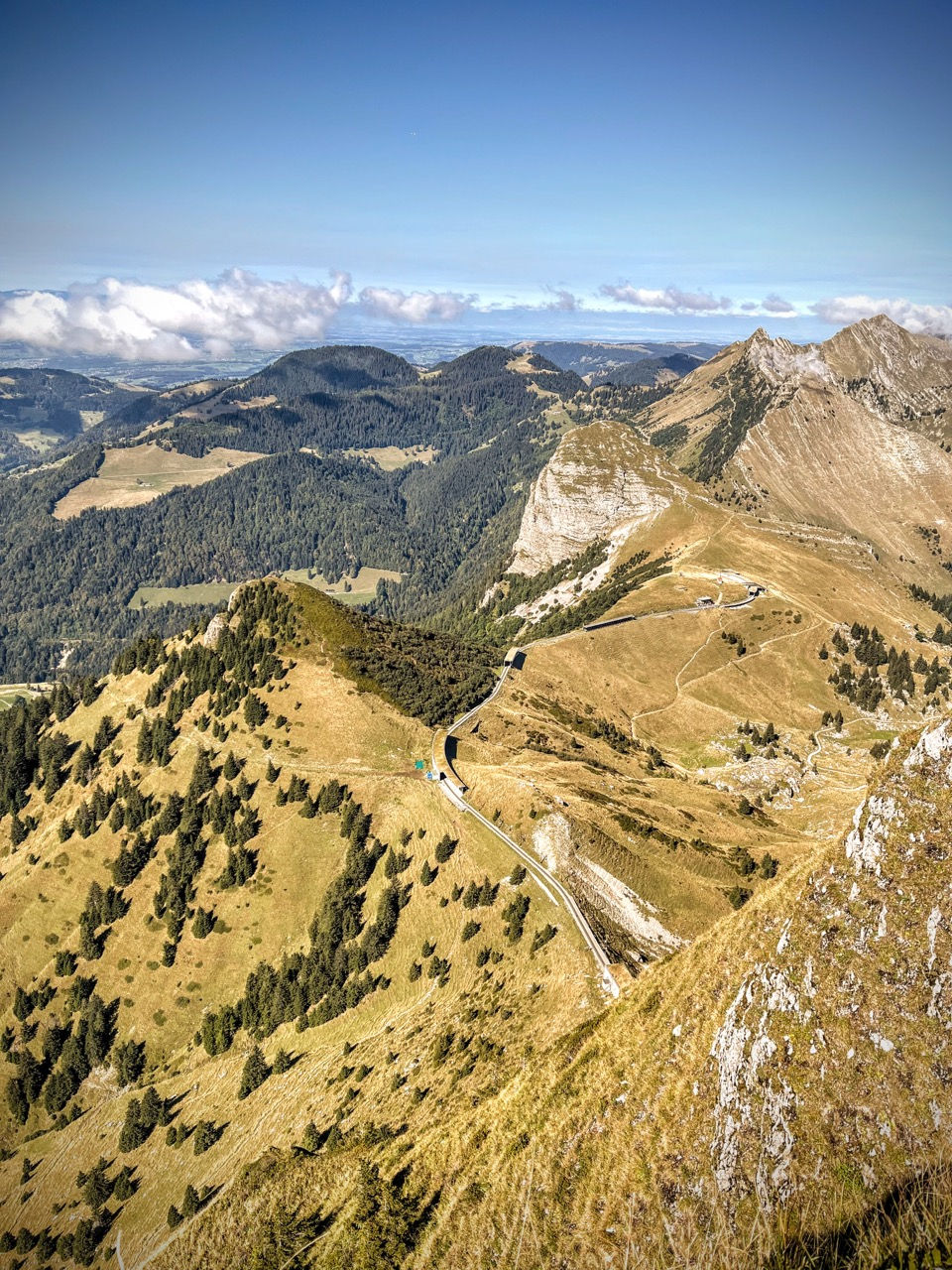
The following 45 minutes of the hike are pretty spectacular — we are following an easy path along the grassy ridges of the Rochers de Naye, which fall vertically on our right, and beyond to the summit of the Rochers de Naye (2042m) - with incredible views over Lake Geneva and an arch of mountains behind us.
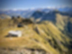
Below the summit, a large gray building with a large terrace and the arrival station of the touristic railway.
Descent: from Rochers de Naye to Col de Jaman
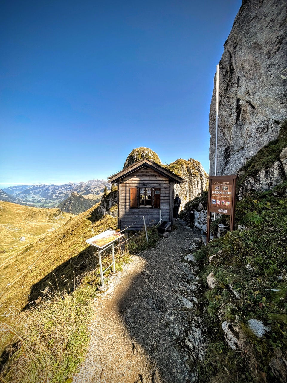
For the descent we complete the ring by descending a panoramic traverse on a wide path up to a saddle with a small house with a view (Sautodoz, 1790m). From there, we circumnavigate a rocky spur of the mountain, walking along its base. We go up slightly to a large grassy shoulder dominated by the train line near the La Perche stop, and we go back down - with spectacular views - first on a path and then on a wide mule track, which takes us back to the Col de Jaman.

MAP
EQUIPMENT
The mountains are a dangerous environment: make sure you always have the right equipment — hiking or trail shoes, warm clothes and waterproofs in case of unexpected changes in weather conditions, a small emergency kit.
I've made an Amazon "shopping note" to make sure you have everything — ps if you buy from these links, 3% goes to support the development and maintenance of Hikes of the World 🙏.
-
Breathable t-shirt ( example )
-
Sweatshirt, fleece, or light jacket
-
Waterproof windbreaker (for example: men / women )
-
Gloves and hat (you never know)
-
Backpack with rain cover
-
Trekking poles (not essential, but they help to unload the weight of the backpack and ease the impact on the joints)
-
Trekking or trail running shoes (in great vogue lately because they are lightweight. These Salomon ones - for men and women - are an excellent entry-level, preferably Gore-Tex)
-
For via ferratas: complete via ferrata kit (I have this one , very light and compact, with this harness and helmet — or you can buy complete kits ). Buy in store to receive ad hoc support
-
To sleep a night in a refuge: sheet or light sleeping bag
-
Water bottle or thermos
-
Light crampons if you think you will find ice or snow on the route
-
Power bank or cell phone charger
-
Camera
-
Drone, for those who love to "fly" (used in moderation and at a distance from other people. I have had the DJI Mini 2 for over 2 years and have found myself very happy with it. The DJI Mini 3 also allows you to take vertical photographs)
-
Small emergency kit ( example )
-
Sun cream (essential)
-
Sunglasses