T
5:00 h
15km
880
10
THE HIKE
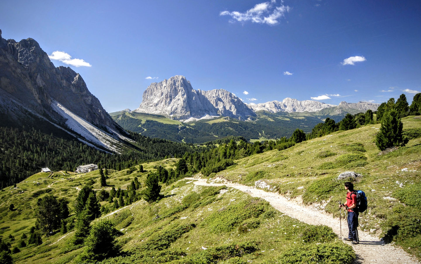
Since 2009, the Dolomites have been a UNESCO World Heritage Site, and it's not hard to see why. They offer towering rock spires rising almost vertically above lush plateaus dotted with alpine pastures. And if this description might seem exaggerated or stereotypical, it certainly isn't the case with this hike. The Seceda plateau, traversed in its entirety on this itinerary, offers postcard-worthy views at every step — it's no wonder it's one of the most famous hikes in the world.
We start from Daunei (1742m), upstream of Selva Val Gardena. Alternatively, you can also start from the parking lot at the bottom of the Col Raiser cable car (a slightly more tedious walking route) or take the cable car up to Col Raiser.
We immediately venture through alpine pastures, huts, small lakes, on the edge of the forest, with Sassolungo peeking behind us.
At Rifugio Juac (Juac Hütte, 1903m, 40 minutes), we descend slightly to the beautiful Lech de Ciaulonch, then continue on a dirt road to Rifugio Firenze in Cisles (Regensburger Hütte, 2040m, 40 minutes).
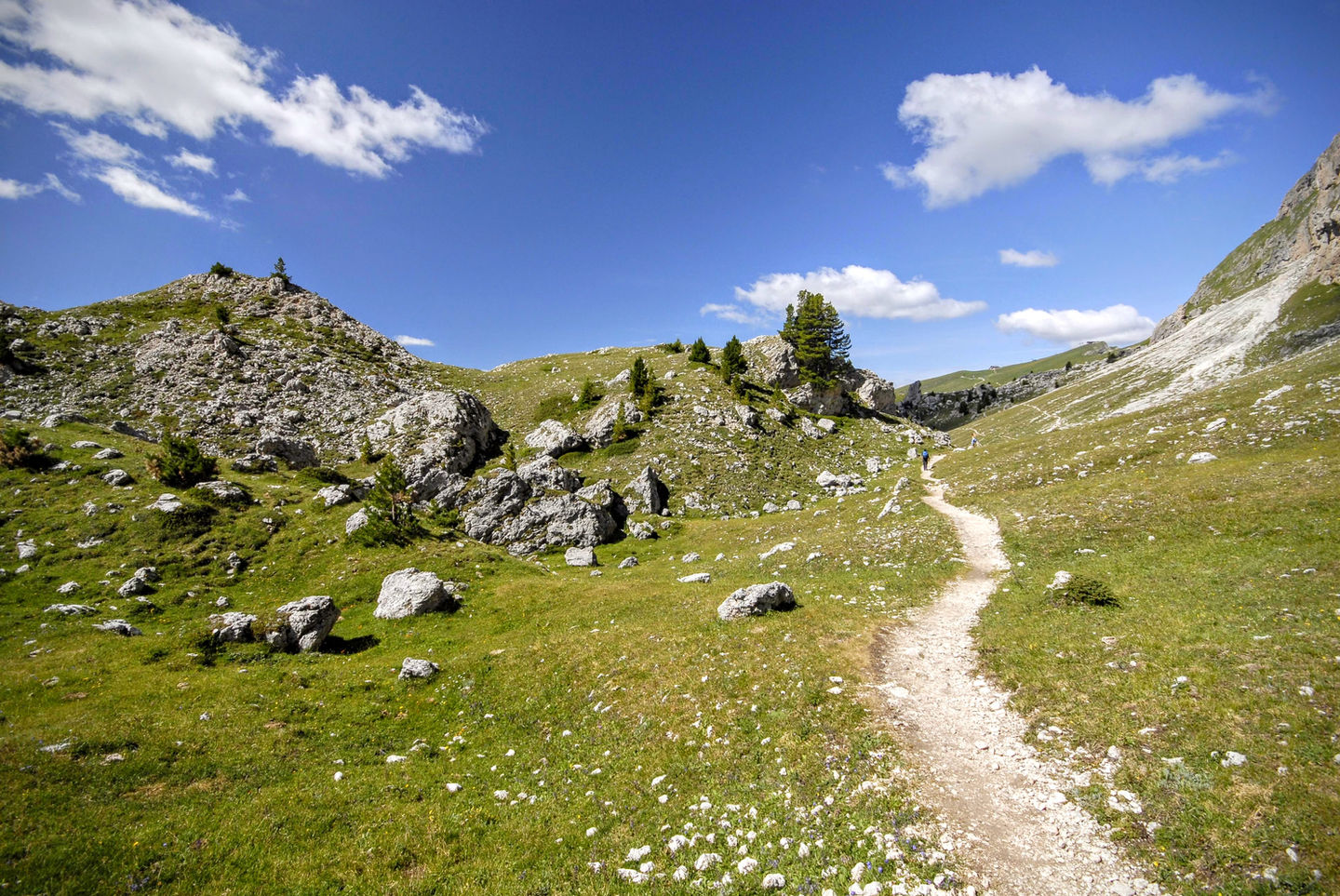
From here, now out of the woods, we take trail 13 towards the southern walls of the Odle. Behind us, Sassolungo and Sassopiatto, and around us, a "hilly" landscape dotted with boulders and fir trees. Once we reach the slopes of the Odle, we turn right, passing through an ancient landslide with boulders over 10m high (= pieces of mountain). We pass by the huts of Pieralongia and Troier (refreshment stops with postcard views) to reach Forcella Pana (2447m) and Seceda (2518m, 1.45 hours). Here, the grassy plain of the southern slope of the Odle drops almost 200 meters into the Val di Funes, offering one of the most famous views in all of the Dolomites.
We descend among huts and alpine pastures to Rifugio Fermeda and Ristoro Sangon (1823m), then briefly ascend to Rifugio Juac, reconnecting with the outbound route (2 hours).
MAP
EQUIPMENT
The mountains are a dangerous environment: make sure you always have the right equipment — hiking or trail shoes, warm clothes and waterproofs in case of unexpected changes in weather conditions, a small emergency kit.
I've made an Amazon "shopping note" to make sure you have everything — ps if you buy from these links, 3% goes to support the development and maintenance of Hikes of the World 🙏.
-
Breathable t-shirt ( example )
-
Sweatshirt, fleece, or light jacket
-
Waterproof windbreaker (for example: men / women )
-
Gloves and hat (you never know)
-
Backpack with rain cover
-
Trekking poles (not essential, but they help to unload the weight of the backpack and ease the impact on the joints)
-
Trekking or trail running shoes (in great vogue lately because they are lightweight. These Salomon ones - for men and women - are an excellent entry-level, preferably Gore-Tex)
-
For via ferratas: complete via ferrata kit (I have this one , very light and compact, with this harness and helmet — or you can buy complete kits ). Buy in store to receive ad hoc support
-
To sleep a night in a refuge: sheet or light sleeping bag
-
Water bottle or thermos
-
Light crampons if you think you will find ice or snow on the route
-
Power bank or cell phone charger
-
Camera
-
Drone, for those who love to "fly" (used in moderation and at a distance from other people. I have had the DJI Mini 2 for over 2 years and have found myself very happy with it. The DJI Mini 3 also allows you to take vertical photographs)
-
Small emergency kit ( example )
-
Sun cream (essential)
-
Sunglasses


