E+
12:00 h
27km
1710
8
THE HIKE
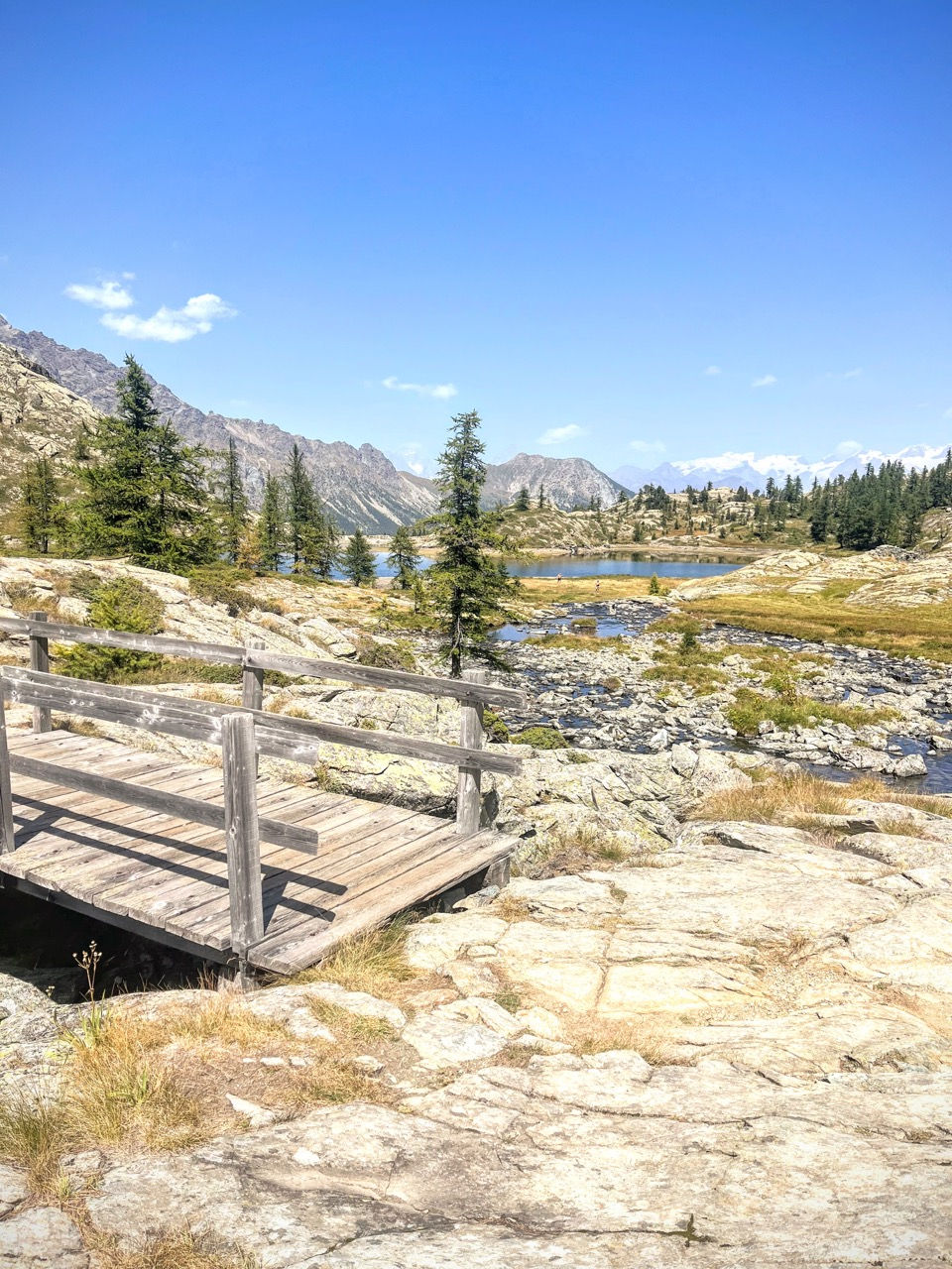
The Monte Avic Natural Park , in the lower Aosta Valley, is famous for a constellation of crystalline lakes, crowned by views of distant Mont Blanc and Monte Rosa.
One of the most famous excursions in the Monte Avic Natural Park is the one to the Barbustel Refuge, and the lakes that surround it, immersed in a sparse larch forest that recalls the wild natural parks of North America. Although the Barbustel Refuge is located in the Champdepraz Valley, most people reach it instead from the Champorcher Valley, where you can start from a higher altitude (around 1750 m, instead of the 1250 m of Covarey, the starting point from the Champdepraz Valley).
This excursion combines the classic excursion to the Barbustel refuge with a long 27km circular tour that culminates at 3153m of Mount Glacier, collecting 7 lakes and small lakes, 3 refuges, and ending the route on the balcony between Dondenaz and Brenvey, dotted with mountain pastures and farmhouses .
Trained hikers can complete the loop in one day, but the excursion can also be broken into 2, stopping at the Barbustel refuge (only 2 hours of walking, making it ideal for an afternoon departure on Friday afternoon) and completing the ring on next day (about 10 hours of walking). If, however, you only intend to go to the Barbustel Refuge, switch to the dedicated excursion.
Day 1 — from Cort to Barbustel Refuge (2 hours)
Having parked the car in one of the car parks near Alpe Cort (1760 m), you start to go up the outlet of Lake Muffé, following its waters and jumping from the left to the orographic right, accompanied by a beautiful forest of fir and larch trees. When the conifers become less sparse, and the path becomes less steep, we spot the Bar Ristoro Muffé hut, a few meters from the transparent waters of Lake Muffé (2080 m, 50 minutes). The short duration of the excursion, the altitude, the crystal clear and not too cold lake (ideal for a swim), and the beauty of the refuge make this place an ideal (and very popular) destination for young families.

Instead, we continue in the direction of Col Lago Bianco (2309 m, 40 minutes), winding across a plateau dotted with sparse larches. Once we reach the pass, we go down into the Champdepraz Valley, and in a few minutes we reach the Barbustel Refuge (2205 m, 15 minutes).
At the Barbustel Refuge we find a similar landscape, characterized by sparse larches, which reveal turquoise lakes, and the snow-capped peaks of Monte Rosa on the horizon. If we plan to spend the night here, we can enjoy the afternoon by taking a dip in White Lake, or taking a walk at the panoramic terrace a few meters north of the refuge, and beyond to the marshy Vallette Lake.

Day 2 — Barbustel refuge, Gran Lago, Monte Glacier, Dondena refuge, Cort
On the second day the bulk of the journey awaits us (approximately 10 hours at a normal pace). We leave the Barbustel Refuge and pass the lake triad of Lago Bianco, Lago Nero, and Lago Cornuto (and we are at 5 lakes collected). We then cross the basin to reach the Gran Lago (2492 m, 1:30 hours), squeezed between the debris of the Gran Rossa and the grassy hills of the Gran Betassa, and the nearby Lago de la Leita and another still unnamed one (and we are at 8).

We cross the large Colle Mezove (2614 m) to descend to the beautiful Lago Margheron/Lago di Mezove (approximately 2380 m, 1:30 hour from the Gran Lago - and we are at 9 lakes), with blue waters and bordered by meadows - ideal for a lunch break.
Less ideal for post-lunch is the steep climb that follows to reach Col d'Eyelé (2803 m, 1:15 hours), along tracks and cairns, then, across, Col Fussi (2912 m, 45 minutes). We find ourselves in a Martian environment, strangely elevated, softened only by the tenth and last lake of this tour, the Lago Gelato, with the view that stretches far to the horizon. And even more so if we dedicate some more effort to reach (on tracks and scree) the summit of Mount Glacier (3152 m, approximately 1:30 for the ascent and descent from Col Fussi).
From Col Fussi a long descent awaits us, first to the Dondena Refuge (2185 m, 2 hours), where we can make a final stop - otherwise we can cut it and save a few minutes of walking. Finally, from the Dondena Refuge we descend through meadows following the tracks of the Alta Via 2 of the Aosta Valley, which run parallel to the Dondenaz dirt road, avoiding for a while eating the dust of the cars that pass by. We pass through a series of bucolic mountain pastures, framed by the Bec Raty and Bec Barmasse cliffs, and then rejoin the dirt road to return to the car (1760 m, 1.45 hours).


MAP
EQUIPMENT
The mountains are a dangerous environment: make sure you always have the right equipment — hiking or trail shoes, warm clothes and waterproofs in case of unexpected changes in weather conditions, a small emergency kit.
I've made an Amazon "shopping note" to make sure you have everything — ps if you buy from these links, 3% goes to support the development and maintenance of Hikes of the World 🙏.
-
Breathable t-shirt ( example )
-
Sweatshirt, fleece, or light jacket
-
Waterproof windbreaker (for example: men / women )
-
Gloves and hat (you never know)
-
Backpack with rain cover
-
Trekking poles (not essential, but they help to unload the weight of the backpack and ease the impact on the joints)
-
Trekking or trail running shoes (in great vogue lately because they are lightweight. These Salomon ones - for men and women - are an excellent entry-level, preferably Gore-Tex)
-
For via ferratas: complete via ferrata kit (I have this one , very light and compact, with this harness and helmet — or you can buy complete kits ). Buy in store to receive ad hoc support
-
To sleep a night in a refuge: sheet or light sleeping bag
-
Water bottle or thermos
-
Light crampons if you think you will find ice or snow on the route
-
Power bank or cell phone charger
-
Camera
-
Drone, for those who love to "fly" (used in moderation and at a distance from other people. I have had the DJI Mini 2 for over 2 years and have found myself very happy with it. The DJI Mini 3 also allows you to take vertical photographs)
-
Small emergency kit ( example )
-
Sun cream (essential)
-
Sunglasses