T
4.30 h
14km
460
10
THE HIKE
The Aletsch Glacier
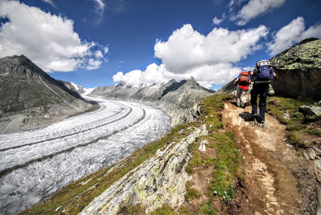
If you love glaciers or are looking for a Himalayan view without having to fly to Nepal, the Aletsch Glacier (Alestchgletscher) is for you. While many other glaciers in the Alps look increasingly sickly, covered in debris, or dismembered in different sections, the Aletsch Glacier has a completely different appearance.
About 20km long, 78km2, and over 1km-wide in some places, it is the longest and largest in the Alps, a UNESCO World Heritage Site since 2001. Even today (2024) it gives the sensation of admiring a glacier coming straight out of the Small Ice Age.

The enormous collecting basin, closed by a curtain of 4000 m, collects a disproportionate quantity of snow, which is then compressed and channeled into a single, relatively narrow and recessed tongue which flows towards the valley at a speed of 200 meters per year. Despite retreating by tens of meters per year, this tongue is still a 20km snake of ice and crevasses (better not to wait too long to visit it, however, because they predict its extinction by 2100).
To remind us how precious and ephemeral it is in years of extreme climate change, in 2007 an artist/photographer, Spencer Tunick, chose the Aletsch for a Greenpeace awareness campaign, having 600 people pose (probably for over an hour) naked on the glacier. Feel free to do the same during your visit to the Aletsch.

Fiesch cable car — Fiescheralp
The classic circular hike to visit the Aletsch Glacier begins at Fiescheralp (2212 m). To get there we have to take the Fiesch - Fiescheralp cable car (27CHF return, 13.50CHF), or one of the others that go up to this plateau. More info and webcam on the Aletsch Arena website.
From Fiescheralp, we start walking SW, first on a dirt road, then on a path till the Hohbalm (m2488, 1 hour). From here, in a few minutes we look out onto the Aletsch Glacier for the first time.
Aletsch Panorama Trail
From here, the gigantic Aletsch Glacier will accompany us for the following 5km. As we push eastwards and go down in altitude, the view becomes more spectacular. We then turn right into the valley that opens north of the Eggishorn and reach the Märjelensee (m2302, 1 hour), dotted with cottongrass in July. From here we can go down to the glacier and touch it with our hands, re-evaluating once again the proportions of this ice giant.

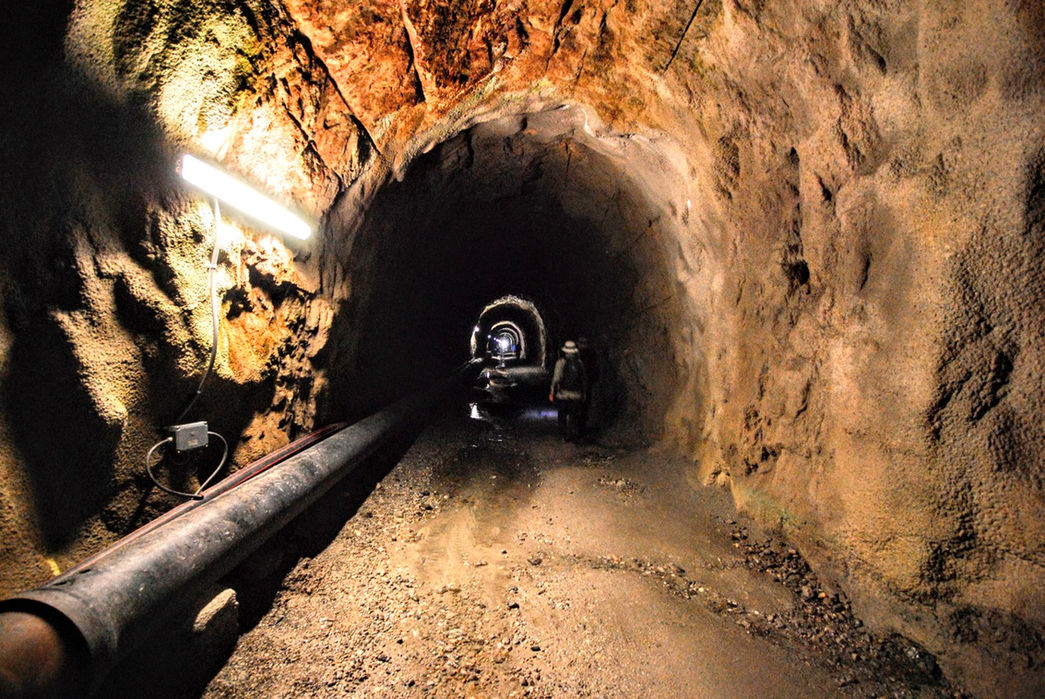
To return we take the Tälligrattunnel, a 1km straight tunnel in the mountain, just a few hundreds meters away from the Märjelen-Gletscherstube. It seems at first glance like a meaningless tunnel / result of overfunding by a local administration, but it had its use when it was dug — as an escape route for the water of the Märjelensee, when the glacier level was higher and risked generating glacial ice flows, flooding the Aletsch valley. Luckily, it has never been used for an emergency.
Coming out of the tunnel, we feel like we've been teleported — the landscape, the light, the view, everything is different. With this micro-stun in mind, we return to the Fiescheralp cable car (m2212, 45 minutes) for the descent to the valley.
Variant of the Eggishorn
Instead of taking the lower panoramic path, you can also follow the entire ridge of Bettmerhorn, Bettmergrat, and Eggishorn — relatively easy, with some sections equipped with chains. Among other things, after the Bettemergrat there is also a short easy via ferrata, the Eggishorn Klettersteig (level B/C), which runs parallel to the normal path to the arrival station of the Eggishorn cable car. Then from the cable car station you can go down to the Tällisee, a tiny lake not even reported by the Kompass but particularly suggestive, and then from there to the Märjelen-Gletscherstube or to Fiescheralp.
MAP
EQUIPMENT
The mountains are a dangerous environment: make sure you always have the right equipment — hiking or trail shoes, warm clothes and waterproofs in case of unexpected changes in weather conditions, a small emergency kit.
I've made an Amazon "shopping note" to make sure you have everything — ps if you buy from these links, 3% goes to support the development and maintenance of Hikes of the World 🙏.
-
Breathable t-shirt ( example )
-
Sweatshirt, fleece, or light jacket
-
Waterproof windbreaker (for example: men / women )
-
Gloves and hat (you never know)
-
Backpack with rain cover
-
Trekking poles (not essential, but they help to unload the weight of the backpack and ease the impact on the joints)
-
Trekking or trail running shoes (in great vogue lately because they are lightweight. These Salomon ones - for men and women - are an excellent entry-level, preferably Gore-Tex)
-
For via ferratas: complete via ferrata kit (I have this one , very light and compact, with this harness and helmet — or you can buy complete kits ). Buy in store to receive ad hoc support
-
To sleep a night in a refuge: sheet or light sleeping bag
-
Water bottle or thermos
-
Light crampons if you think you will find ice or snow on the route
-
Power bank or cell phone charger
-
Camera
-
Drone, for those who love to "fly" (used in moderation and at a distance from other people. I have had the DJI Mini 2 for over 2 years and have found myself very happy with it. The DJI Mini 3 also allows you to take vertical photographs)
-
Small emergency kit ( example )
-
Sun cream (essential)
-
Sunglasses


