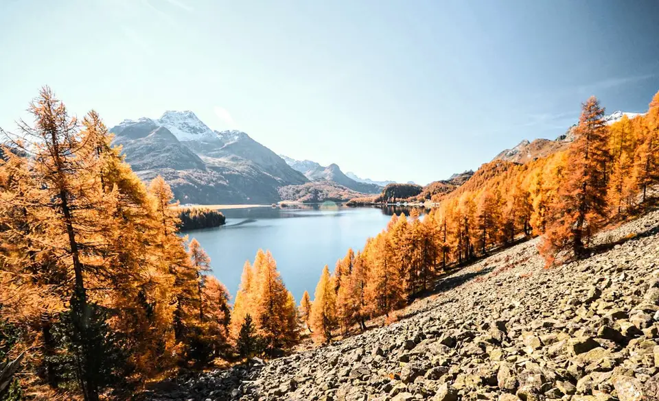
The balcony path from Silvaplana to the Maloja Pass
The Engadine is the Swiss valley most easily reached from Milan, over the Maloja Pass, and it is also one of the most generous in the Alps: within a few kilometres lie the lakes of Sils and Silvaplana, the glaciers of the Bernina and the larch woods that turn gold in October.
The hikes on this page range from the easy balcony path between Silvaplana and Maloja to the long walk up to the Capanna del Forno, and almost all of them can be paired with a return by train or PostBus.
Good to know about the Engadine
The Engadine is one of the valleys where Romansh survives, a Rhaeto-Romance language that has two varieties here: Putèr in the Upper Engadine and Vallader in the Lower Engadine. You read it in the place names, from Munt La Schera to Lunghin, and often on the fronts of Engadine houses, with thick walls, splayed windows and sgraffito decoration scratched into the plaster, which in many villages is protected by cantonal law. The Albula line of the Rhaetian Railway also reaches the valley, ending at St. Moritz, and it has been a World Heritage site since 2008 together with the Bernina line, which makes it handy for getting back to your starting point.
Alp and Munt La Schera lie inside the Swiss National Park, founded in 1914 and the oldest in the Alps, where the rules are strict: you do not leave the marked paths, dogs are not allowed even on a lead and you may neither camp nor sleep outdoors. At the other end of the valley, the Lunghin Pass is one of Europe's rare triple watersheds, where water runs to the North Sea with the Rhine, to the Mediterranean with the Po and to the Black Sea with the Danube. The Lägh dal Lunghin, just below Piz Lunghin, is regarded as the source of the Inn, the river that gives the valley its very name.
The hikes
By our rating, highest first. Browse them as photographs, as a list with all the numbers or on the map.
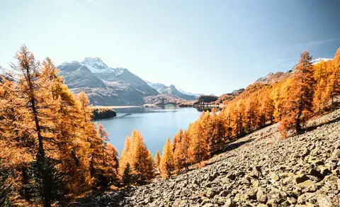 SwitzerlandThe balcony path from Silvaplana to the Maloja PassAn easy balcony path dominated by breathtaking views of Lake Sils and Lake Silvaplana, with the Bernina and the peaks of the Bregaglia in the background.
- Grade
- T
- Time
- 4:00h
- Distance
- 13km
- Ascent
- 470m
- Rating
- 8/10
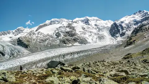 SwitzerlandCapanna Boval and the Morteratsch GlacierFace to face with the Bernina, in a commanding glacial setting.
- Grade
- E
- Time
- 5:00h
- Distance
- 14km
- Ascent
- 640m
- Rating
- 8/10
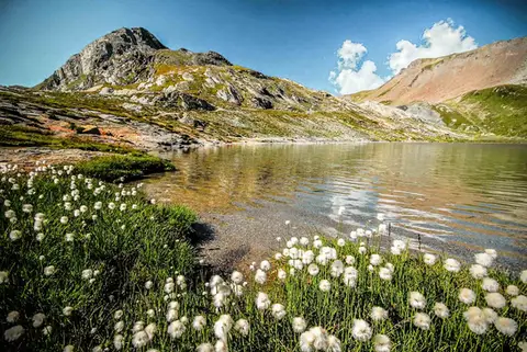 SwitzerlandLago Lunghin and Piz LunghinA lake, a peak and a pass, all sharing a breathtaking view over the Bernina group and the Lago di Sils.
- Grade
- E
- Time
- 6:30h
- Distance
- 16km
- Ascent
- 1,030m
- Rating
- 8/10
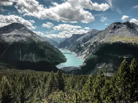 SwitzerlandAlp and Munt La Schera, lookouts over Lago di LivignoNorth American views, with the turquoise Lago di Livigno and broad valleys cloaked in firs and larches.
- Grade
- E
- Time
- 4:30h
- Distance
- 13km
- Ascent
- 810m
- Rating
- 7/10
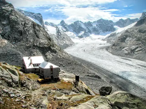 SwitzerlandCapanna del Forno and the Forno GlacierA long walk up the Valle del Forno, repaid with views worthy of Patagonia.
- Grade
- EE
- Time
- 8:00h
- Distance
- 21km
- Ascent
- 1,020m
- Rating
- 7/10
Questions
The answers come from the hike pages listed here.
Which one is the best, in your view?
The balcony path from Silvaplana to the Maloja Pass, Capanna Boval and the Morteratsch Glacier, Lago Lunghin and Piz Lunghin, all rated 8 out of 10.
Which one is the easiest?
The balcony path from Silvaplana to the Maloja Pass: grade T, 4:00 hours of walking and 470 metres of ascent.
How long do these hikes take?
From 4:00 to 8:00 hours of walking, with ascents between 470 and 1,030 metres.
More guides
Other lists that share some of these hikes.