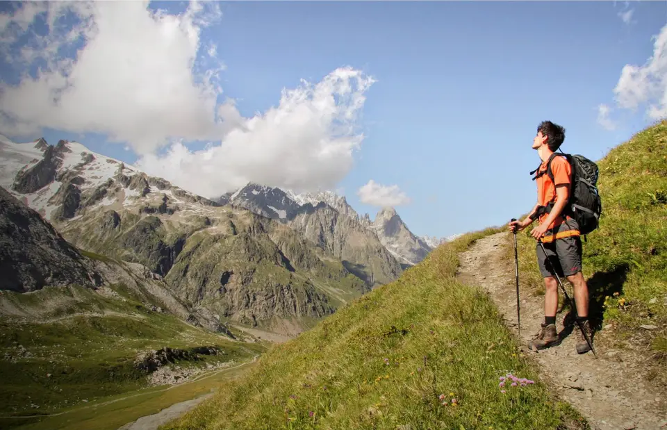
Afternoon light strikes the ramparts of the Mont Blanc group. Here we are on the path down from the Col de Chavannes to the Rifugio Elisabetta Soldini, on the Monte Fortin hike.
The Aosta Valley, like the Dolomites, has something magical about it: perhaps the symmetry and straightness of its valley, perhaps the vertical range from the 530 metres of Aosta to the 4,810 metres of Mont Blanc, perhaps its centuries-old culture or its cuisine. It is a calm, contemplative charm that takes hold of you when you walk past the rock ramparts of Mont Blanc among flowering meadows, or when you venture into the more remote valleys in the south of the Aosta Valley.
The jewel of the Aosta Valley is the pair of symmetrical, straight valleys that embrace Mont Blanc, the highest mountain group in Europe. Val Veny and Val Ferret are so symmetrical and so aesthetically perfect that it seems almost impossible they were shaped by an unwitting hand. In both, the finest hikes climb the slope opposite the Mont Blanc group, offering incredible views of it; not to be missed are the hikes to Monte Fortin, to the Rifugio Bertone and the Testa de la Tronche, and to the Rifugio Bonatti. Courmayeur and the nearby villages are perfect for a stay of several days to explore the valleys properly.
The second best-known part of the Aosta Valley is Valtournenche and Cervinia, a historic hiking and ski resort at 2,000 metres, at the foot of the pyramid of the Matterhorn. The south side of the Matterhorn, a pinnacle of crumbly rock attached to a fault of hard rock, is less famous for its looks than the north side, but just as spectacular.
If you are looking for quieter, more remote valleys, the Aosta Valley has plenty. Arranged like the teeth of a comb to the north and south of the main trench of the Aosta Valley, they offer many more hikes, marked by little tourist development and remarkable wildlife (especially in the Gran Paradiso National Park, where meeting ibex or chamois is almost the norm). Be ready for considerable elevation gains, because these valleys are long and deep, and few roads climb their slopes.
The Aosta Valley is crossed by 2 treks, the Alta Via 1 and the Alta Via 2 of the Aosta Valley, and by the famous and spectacular Tour du Mont Blanc, a complete loop around the entire Mont Blanc group. Some run it in a day, others take 15 days; the choice is yours.
Good to know about the Aosta Valley
The Aosta Valley is a bilingual region, where French is an official language alongside Italian, but in some side valleys other languages are spoken too. The Lys valley is home to Walser communities, descendants of German-speaking settlers who came from the Upper Valais from the thirteenth century onwards, invited by monasteries and feudal lords to clear the high valleys. In Gressoney people speak Titsch, in Issime Töitschu, considered even more archaic, and the timber houses on stone bases that you see on the way up towards Monte Rosa are the most visible sign of that settlement.
Fontina DOP is made with raw whole milk from Valdostana cows, from a single milking, and since 2023 Fontina d'alpeggio, produced in summer on the high pastures, has had a separate designation of its own. The region's pastures and forests are also the reason for its parks: Gran Paradiso was founded in 1922 as Italy's first national park, on the land of a royal hunting reserve that had saved the ibex from extinction. Smaller and more recent, the Mont Avic Natural Park, home to Rifugio Barbustel and the ten-lakes loop, was established in 1989 as the region's first natural park, partly to protect its extensive forests of mountain pine.
The hikes
By our rating, highest first. Browse them as photographs, as a list with all the numbers or on the map.
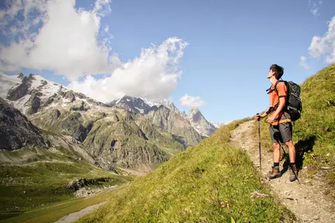 Aosta ValleyMonte Fortin and Rifugio Elisabetta Soldini in Val VenyA sensational viewing terrace over Monte Bianco and the Himalayan-looking Miage Glacier.
- Grade
- E
- Time
- 7:30h
- Distance
- 21km
- Ascent
- 1,190m
- Rating
- 9/10
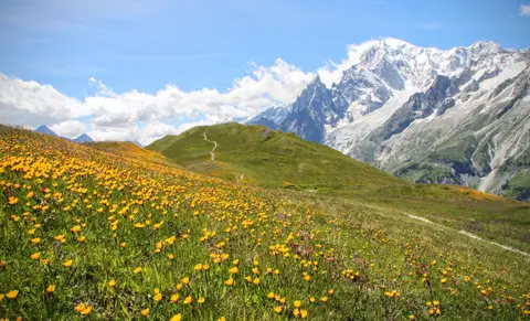 Aosta ValleyRifugio Bertone and Testa della Tronche, a balcony over Monte BiancoIn Val Ferret, on a grassy ridge face to face with the giants of Monte Bianco.
- Grade
- E
- Time
- 6:30h
- Distance
- 16km
- Ascent
- 1,010m
- Rating
- 9/10
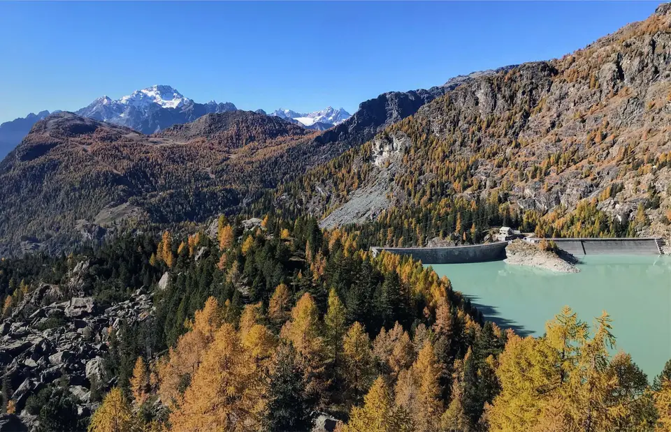
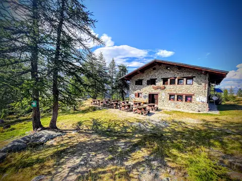 Aosta ValleyTo Rifugio Barbustel, in the heart of the Monte Avic Natural ParkCrystal-clear lakes and larch woods with a North American feel, in under 3 hours of walking.
- Grade
- T
- Time
- 4:30h
- Distance
- 9.6km
- Ascent
- 700m
- Rating
- 8/10
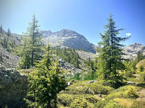 Aosta ValleyThe Monte Avic 10-lake loop (2 days)10 lakes, 3 mountain huts and a 3000-metre peak. A long 27km loop in the Monte Avic Natural Park, almost entirely in stern alpine terrain between 2000 and 3000 metres.
- Grade
- E+
- Time
- 12:00h
- Distance
- 27km
- Ascent
- 1,710m
- Rating
- 8/10
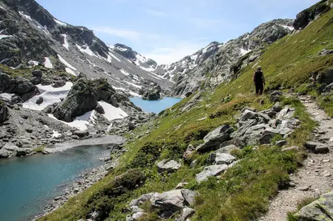 Aosta ValleyLakes, glaciers and waterfalls in the Valle del RutorA hike to Rifugio Deffeyes past the Rutor Falls, face to face with the Rutor Glacier.
- Grade
- E
- Time
- 7:30h
- Distance
- 20km
- Ascent
- 1,070m
- Rating
- 8/10
Questions
The answers come from the hike pages listed here.
Which one is the best, in your view?
Monte Fortin and Rifugio Elisabetta Soldini in Val Veny and Rifugio Bertone and Testa della Tronche, a balcony over Monte Bianco, all rated 9 out of 10.
Which one is the easiest?
To Rifugio Barbustel, in the heart of the Monte Avic Natural Park: grade T, 4:30 hours of walking and 700 metres of ascent.
How long do these hikes take?
From 4:30 to 12:00 hours of walking, with ascents between 700 and 1,710 metres.
More guides
Other lists that share some of these hikes.