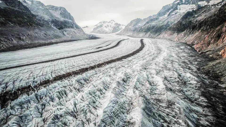
A drone view of the Aletsch Glacier, the largest in the Alps. More than 18 km long, it is about 1 km wide at the point where this photo was taken.
If you can choose, the hikes in this section perhaps deserve the highest priority. Because of climate change, all the glaciers of the Alps are retreating by tens, if not hundreds, of metres a year. They are expected to have disappeared completely by 2100. If you love glaciers, it is best to go and see them as soon as possible.
This section includes some hikes to the most beautiful glaciers in the Alps, or to ones that were when the hike pages were written. Some photos may be years old, so do not set your expectations too high.
Good to know about glaciers
In Switzerland the GLAMOS monitoring network measures glacier volume every year, and the recent figures give a sense of how fast the retreat is: about 6 per cent lost in 2022, the worst result since measurements began, about 4 per cent in 2023 and about 3 per cent in 2025, close to a quarter of the volume in total between 2015 and 2025. Along the path to the Morteratsch, signs mark where the glacier tongue reached in past years: at its greatest extent, shortly after 1860, it stopped a few dozen metres from today's railway station, and since then it has retreated by about two and a half kilometres. The Aletsch, about 23 kilometres long, is still the longest glacier in the Alps, but it too grows shorter every year.
The hikes on this page reach the edge of the glacier, and that is where they should stop: walking on the ice, among crevasses often hidden by snow, is mountaineering, and it requires equipment, a rope and the skills to use them. Even on solid ground it is wise not to linger beneath ice fronts and seracs, which collapse unpredictably, above all on hot days, when meltwater runs between ice and rock. Lakes that form on glaciers or in front of their snouts can grow quickly, as happened in 2002 on the Belvedere, where the Lago Effimero led to a state of emergency being declared, so they are always best watched from a distance.
The hikes
By our rating, highest first. Browse them as photographs, as a list with all the numbers or on the map.
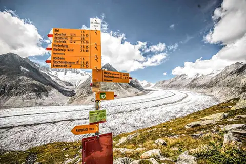 SwitzerlandAletsch Glacier (Aletschgletscher)The most classic walk to the Aletsch Glacier, the largest glacier in the Alps.
- Grade
- T
- Time
- 4:30h
- Distance
- 14km
- Ascent
- 460m
- Rating
- 10/10
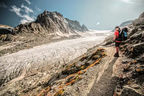 SwitzerlandGlacier d'Orny and Cabane du TrientA walk to the imposing Glacier d'Orny, in the Mont Blanc massif
- Grade
- E
- Time
- 6:00h
- Distance
- 13km
- Ascent
- 970m
- Rating
- 9/10
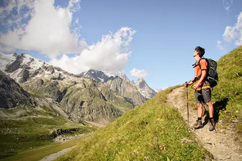 Aosta ValleyMonte Fortin and Rifugio Elisabetta Soldini in Val VenyA sensational viewing terrace over Monte Bianco and the Himalayan-looking Miage Glacier.
- Grade
- E
- Time
- 7:30h
- Distance
- 21km
- Ascent
- 1,190m
- Rating
- 9/10
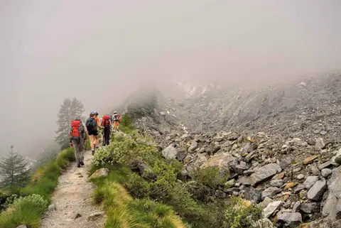 PiedmontRifugio Zamboni Zappa on the Belvedere GlacierAt the foot of the 4000-metre peaks of Monte Rosa, the hike to Rifugio Zamboni Zappa is a tour in glaciology.
- Grade
- E
- Time
- 5:30h
- Distance
- 13km
- Ascent
- 870m
- Rating
- 8/10
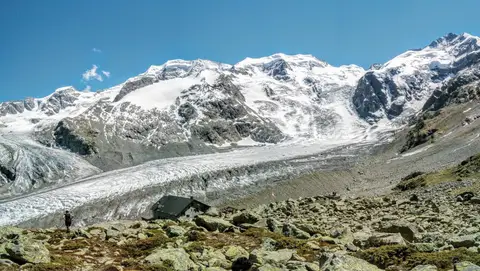 SwitzerlandCapanna Boval and the Morteratsch GlacierFace to face with the Bernina, in a commanding glacial setting.
- Grade
- E
- Time
- 5:00h
- Distance
- 14km
- Ascent
- 640m
- Rating
- 8/10
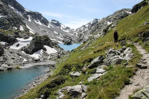 Aosta ValleyLakes, glaciers and waterfalls in the Valle del RutorA hike to Rifugio Deffeyes past the Rutor Falls, face to face with the Rutor Glacier.
- Grade
- E
- Time
- 7:30h
- Distance
- 20km
- Ascent
- 1,070m
- Rating
- 8/10
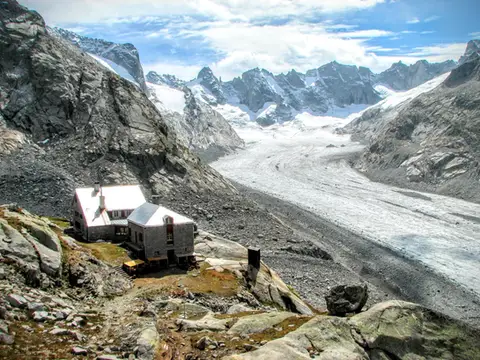 SwitzerlandCapanna del Forno and the Forno GlacierA long walk up the Valle del Forno, repaid with views worthy of Patagonia.
- Grade
- EE
- Time
- 8:00h
- Distance
- 21km
- Ascent
- 1,020m
- Rating
- 7/10
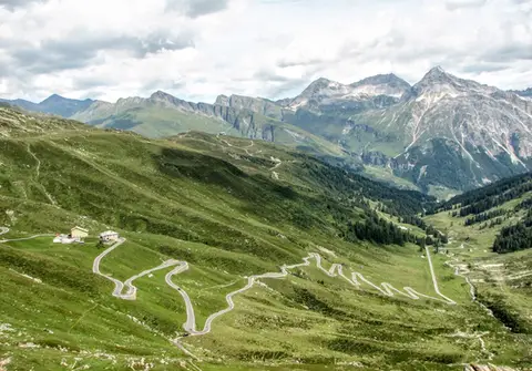 ValchiavennaBivacco del Suretta from the Passo dello SplugaA panoramic loop straddling the Passo dello Spluga, culminating at the Bivacco del Suretta
- Grade
- E
- Time
- 5:00h
- Distance
- 11km
- Ascent
- 850m
- Rating
- 7/10
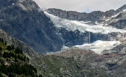 ValtellinaRifugio Bignami and the Marson Glacier Trail at the FellariaIn the upper Valmalenco, face to face with the Fellaria Glacier.
- Grade
- E
- Time
- 5:30h
- Distance
- 15km
- Ascent
- 670m
- Rating
- 7/10
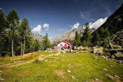 ValtellinaRifugio Gerli Porro and the Ventina Glacier TrailDiscovering Alpe Ventina, on the trail of a retreating glacier.
- Grade
- T
- Time
- 3:30h
- Distance
- 10km
- Ascent
- 700m
- Rating
- 7/10
Questions
The answers come from the hike pages listed here.
Which one is the best, in your view?
Aletsch Glacier (Aletschgletscher), which we rated 10 out of 10.
Which one is the easiest?
Aletsch Glacier (Aletschgletscher): grade T, 4:30 hours of walking and 460 metres of ascent.
How long do these hikes take?
From 3:30 to 8:00 hours of walking, with ascents between 460 and 1,190 metres.
More guides
Other lists that share some of these hikes.