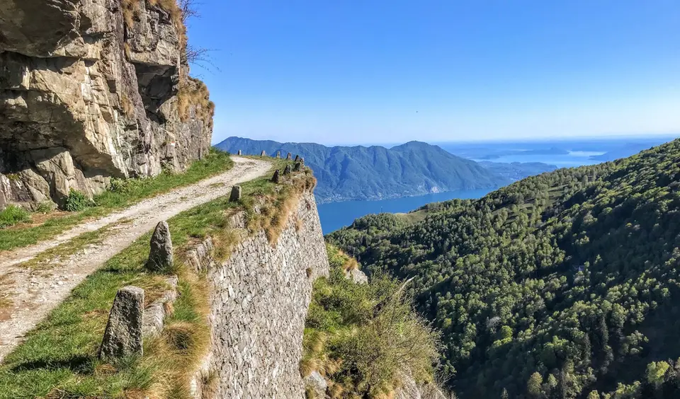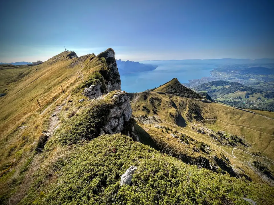
October is the month of the larches, and almost our whole list revolves around them: the only conifer in the Alps that sheds its needles turns yellow and then orange, and for a few weeks the valleys of the Engadine, Valmalenco and the Aosta Valley change their appearance completely. The exact moment varies from year to year and from valley to valley, because it depends on the first frosts, and it is better followed closely than fixed in September. The days are shorter and cooler, most high huts are closed, but the low autumn light is the best of the year.
In Val di Campo, above Poschiavo, the Saoseo and Viola lakes are at their best between October and November, and it is among the hikes we have scored highest. In the Engadine, the balcony path from Silvaplana to the Maloja Pass looks over the lakes of Sils and Silvaplana with the Bernina behind, while in Valmalenco the short walk to the Rifugio Cristina at Alpe Prabello crosses a larch wood at the foot of Pizzo Scalino. Lower down, the Acquafraggia waterfalls and the Sentiero del Cardinello in Valchiavenna become pleasant again after the summer heat.
Good to know
In the Swiss National Park the larch needles turn yellow in October, with the colour usually peaking around the middle of the month, and fall in the first half of November; the Graubünden tourist board points out that the change comes only after several nights of frost, which is why it varies so much from one year to the next. On the last Sunday of October Europe goes back to standard time, and from that day darkness arrives an hour earlier: on long hikes it is the moment to bring the start forward, not the return.
October is also the month of chestnuts. In Valchiavenna chestnut woods line many of the lower paths, and the crotti, natural cellars among the boulders where the air stays cool all year, are the classic place to end a day on foot, while in South Tyrol the Törggelen begins, the tradition of going from farm to farm to taste the new wine with roast chestnuts and country dishes.
The hikes
By our rating, highest first. Browse them as photographs, as a list with all the numbers or on the map.
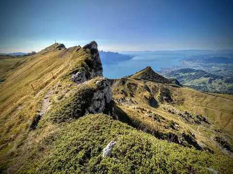 SwitzerlandTo the Rochers de Naye, a balcony over Lake GenevaThe 2000-metre peak closest to Lake Geneva: half green plateau, half vertical rock pinnacle.
- Grade
- E+
- Time
- 4:00h
- Distance
- 10km
- Ascent
- 550m
- Rating
- 9/10
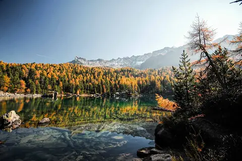 SwitzerlandLago di Saoseo and Lago Viola in the Val di CampoTwo gems of lakes in a valley dotted with alpine pastures. At its best between October and November.
- Grade
- T
- Time
- 4:30h
- Distance
- 13km
- Ascent
- 550m
- Rating
- 9/10
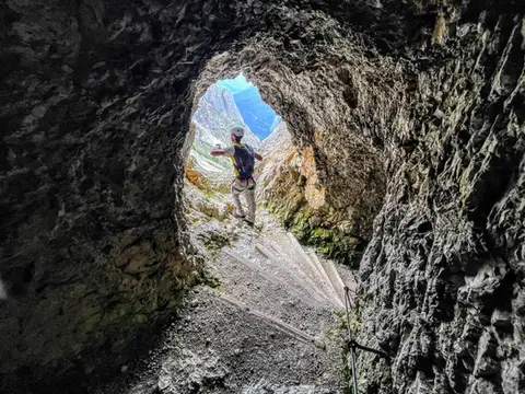 DolomitesLagazuoi loop hike300m of ascent through military galleries and tunnels to the panoramic terrace of the Lagazuoi. Optional: the Ferrata degli Alpini on the Col dei Bos (C/D)
- Grade
- E
- Time
- 5:00h
- Distance
- 10km
- Ascent
- 700m
- Rating
- 8/10
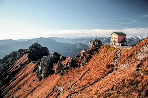 Lake ComoFrom Piani Resinelli to Rifugio RosalbaOne of the great classics of the Lombard Prealps. Dolomite-like views, an hour's drive from Milan.
- Grade
- E
- Time
- 3:00h
- Distance
- 6km
- Ascent
- 530m
- Rating
- 8/10
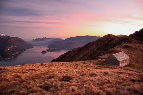 Lake ComoMonte Grona and Monte BregagnoAlong the grassy ridge between Monte Grona and Bregagno, face to face with Lake Como.
- Grade
- E
- Time
- 6:00h
- Distance
- 13km
- Ascent
- 1,120m
- Rating
- 8/10
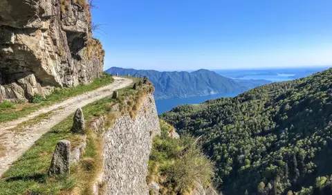 PiedmontCima di Morissolo and the Linea Cadorna fortificationsA summit dropping sheer to Lake Maggiore, just 30 minutes' walk away, with a maze of Linea Cadorna tunnels.
- Grade
- T
- Time
- 1:30h
- Distance
- 3.5km
- Ascent
- 170m
- Rating
- 8/10
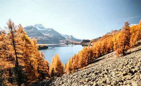 SwitzerlandThe balcony path from Silvaplana to the Maloja PassAn easy balcony path dominated by breathtaking views of Lake Sils and Lake Silvaplana, with the Bernina and the peaks of the Bregaglia in the background.
- Grade
- T
- Time
- 4:00h
- Distance
- 13km
- Ascent
- 470m
- Rating
- 8/10
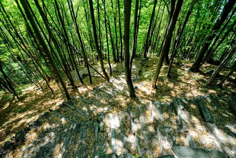 ValchiavennaAcquafraggia Falls, Savogno and DasileA loop around the Acquafraggia Falls: ladders, pools, Lilliputian villages and old mule tracks.
- Grade
- T
- Time
- 3:00h
- Distance
- 5.5km
- Ascent
- 620m
- Rating
- 8/10
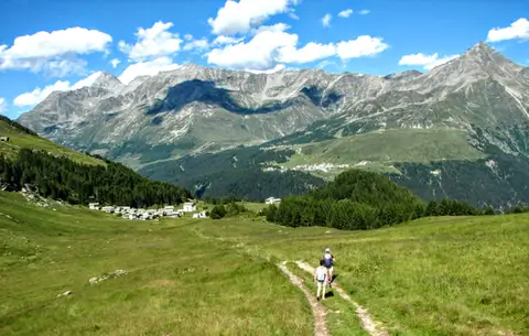 ValchiavennaThe Lago Bianco loop on the Pian dei CavalliOn the balcony of the Valle Spluga: from Starleggia to the Pian dei Cavalli, the Lago Bianco and Monte Bardan.
- Grade
- E
- Time
- 4:00h
- Distance
- 10km
- Ascent
- 830m
- Rating
- 8/10
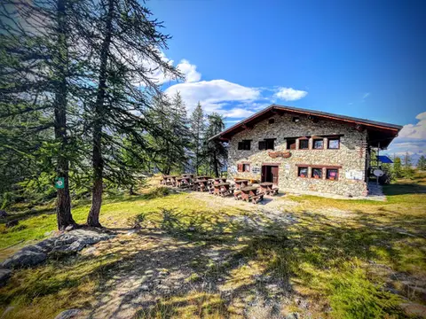 Aosta ValleyTo Rifugio Barbustel, in the heart of the Monte Avic Natural ParkCrystal-clear lakes and larch woods with a North American feel, in under 3 hours of walking.
- Grade
- T
- Time
- 4:30h
- Distance
- 9.6km
- Ascent
- 700m
- Rating
- 8/10
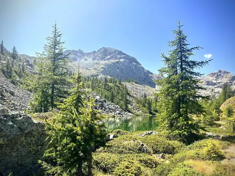 Aosta ValleyThe Monte Avic 10-lake loop (2 days)10 lakes, 3 mountain huts and a 3000-metre peak. A long 27km loop in the Monte Avic Natural Park, almost entirely in stern alpine terrain between 2000 and 3000 metres.
- Grade
- E+
- Time
- 12:00h
- Distance
- 27km
- Ascent
- 1,710m
- Rating
- 8/10
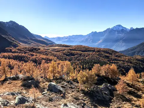 ValtellinaRifugio Cristina, a balcony over the larch woods of the ValmalencoA short walk to Rifugio Cristina at Alpe Prabello, at the foot of Pizzo Scalino.
- Grade
- T
- Time
- 2:00h
- Distance
- 6.5km
- Ascent
- 230m
- Rating
- 8/10
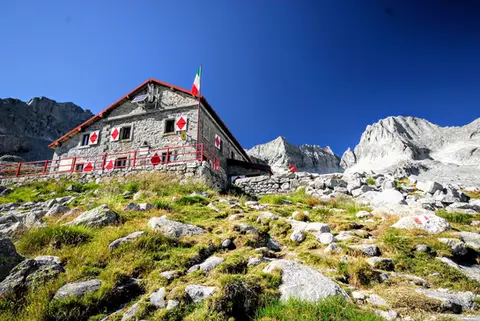 ValtellinaRifugio Gianetti in Val MasinoAn essential stop in the mountains of Lombardy, face to face with the granite giants of Val Masino.
- Grade
- E/EE
- Time
- 7:30h
- Distance
- 15km
- Ascent
- 1,480m
- Rating
- 8/10
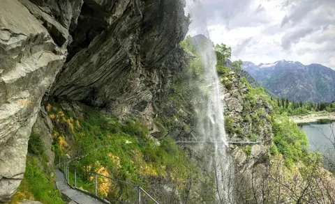 PiedmontThe Valle Antrona loop: Lago Antrona and Lago di CampliccioliA short hike around the lakes of Antrona and Campliccioli, in the lower Valle Antrona.
- Grade
- T
- Time
- 3:00h
- Distance
- 10km
- Ascent
- 400m
- Rating
- 7/10
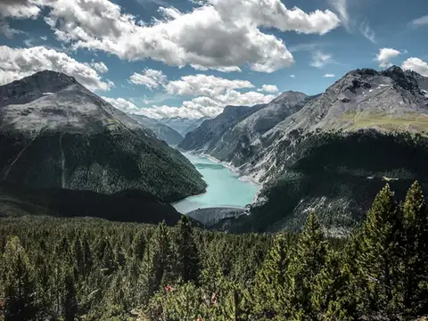 SwitzerlandAlp and Munt La Schera, lookouts over Lago di LivignoNorth American views, with the turquoise Lago di Livigno and broad valleys cloaked in firs and larches.
- Grade
- E
- Time
- 4:30h
- Distance
- 13km
- Ascent
- 810m
- Rating
- 7/10
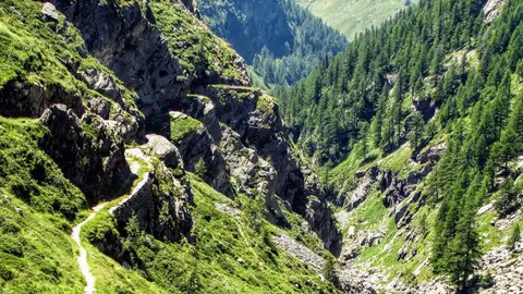 ValchiavennaThe Sentiero del Cardinello (or Via Mala)Carved into the rock of a narrow gorge, the Sentiero del Cardinello is one of the oldest and most spectacular stretches of the Via Spluga.
- Grade
- E
- Time
- 4:30h
- Distance
- 12km
- Ascent
- 660m
- Rating
- 7/10
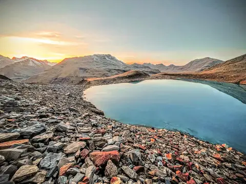 Valtellina · SwitzerlandLago Vago, the blue pearl of LivignoA short hike to Lago Vago, a Caribbean-looking tarn so blue it seems fake.
- Grade
- E
- Time
- 3:00h
- Distance
- 6km
- Ascent
- 520m
- Rating
- 7/10
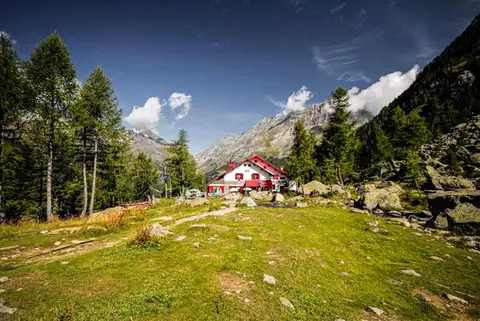 ValtellinaRifugio Gerli Porro and the Ventina Glacier TrailDiscovering Alpe Ventina, on the trail of a retreating glacier.
- Grade
- T
- Time
- 3:30h
- Distance
- 10km
- Ascent
- 700m
- Rating
- 7/10
Questions
The answers come from the hike pages listed here.
Which one is the best, in your view?
To the Rochers de Naye, a balcony over Lake Geneva and Lago di Saoseo and Lago Viola in the Val di Campo, all rated 9 out of 10.
Which one is the easiest?
Cima di Morissolo and the Linea Cadorna fortifications: grade T, 1:30 hours of walking and 170 metres of ascent.
How long do these hikes take?
From 1:30 to 12:00 hours of walking, with ascents between 170 and 1,710 metres.
More guides
Other lists that share some of these hikes.